Our team has a diverse background in geospatial analysis and product development. We use Geographic Information Systems (GIS), Geospatial Analysis, and Cartography to fully convey environmental, natural, and cultural resource information needed to complete projects. Services include:
Data Integration and Management
Spatial Data Analysis and Modeling
Remote Sensing Data Collection and Integration
GPS Data Collection and Post-processing
Environmental and Cultural Electronic Data Management
Short and Long Term Monitoring in Support of Cultural and Natural Resources
Project Planning, Feasibility Planning and Resource Management Planning
Site/Area or Condition Characterization and Evaluation
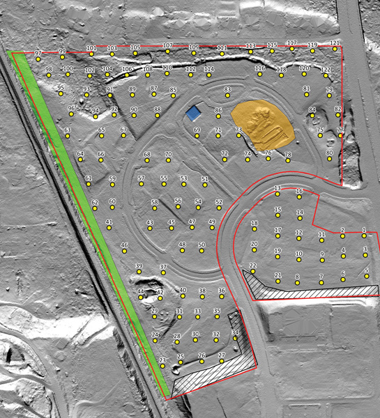
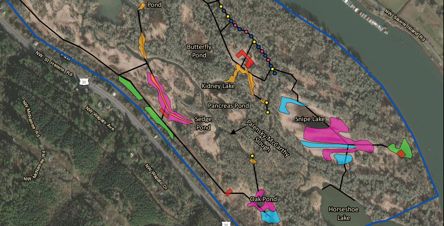
Digital 3D Mapping. Documentation, and Analysis of Archaeological Sites and Historic Structures. A precise, high-resolution photorealistic model of a historical building or archaeological landscape can be used for archival documentation and dynamic visual display.
Drones
REMOTELY SENSED GEOSPATIAL DATA SERVICES
We offer drone services to support of a variety of remotely sensed geospatial applications including:
Orthomosaic Imaging
Digital Terrain Modeling (DTM)
3D Modeling and Aerial Documentation and Reconnaissance.
Using drones offers a fast, efficient, and cost effective alternative to traditional landscape scale aerial imaging and mapping techniques from manned aircraft. Drones can capture imagery of: