TONTO NATIONAL MONUMENT & TUMACACORI NATIONAL HISTORICAL PARK, USNP SERVICE, AZ
ARCHAEOLOGICAL MAPPING & DOCUMENTATION
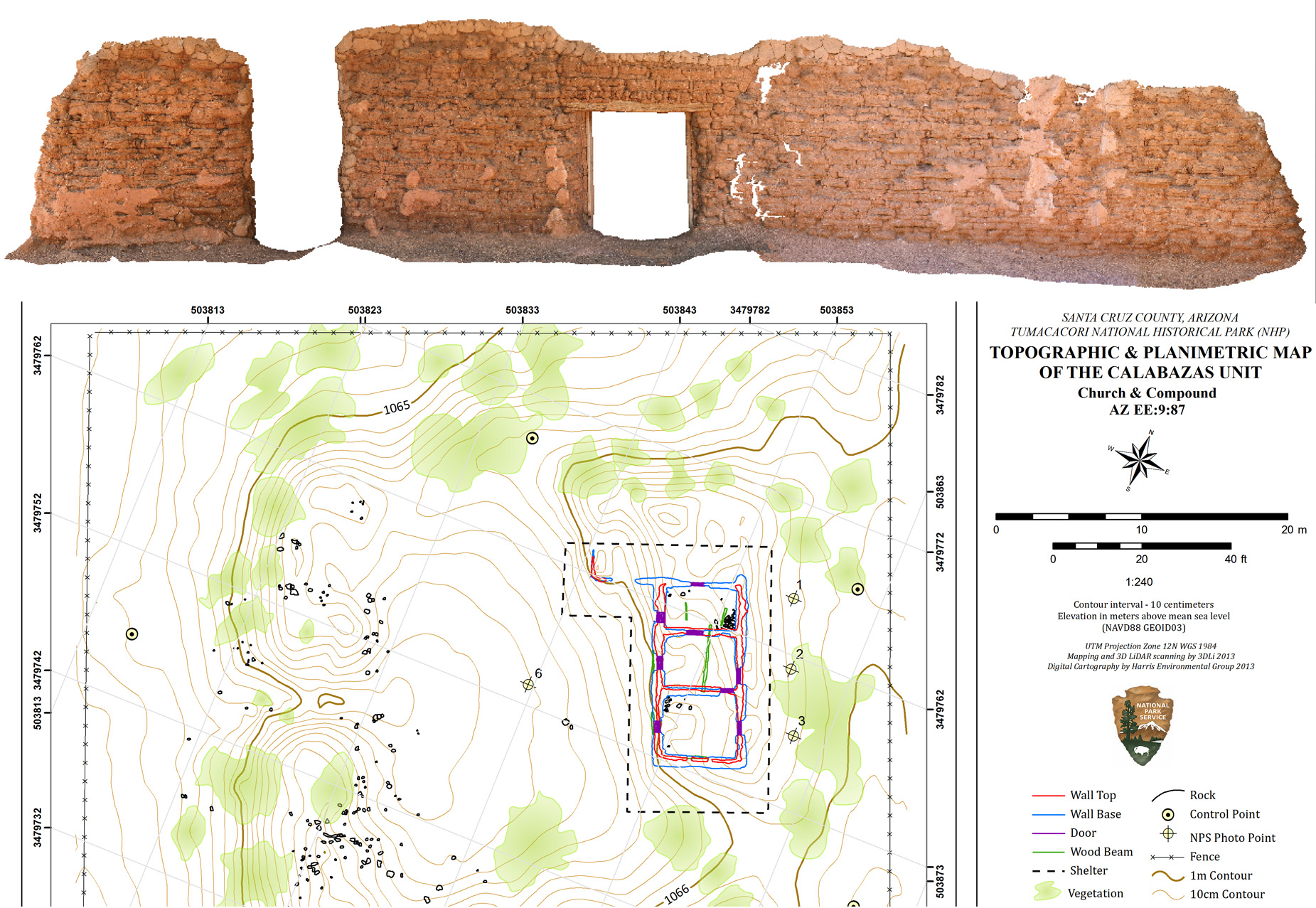
Harris Environmental worked with the National Park Service at two park units. First, we mapped two 17th Century missions (Los Santos Angeles de Guevavi and Calabasas Convento), part of Tumacacori National Historic Park. With LiDAR, we scanned the standing structures of both missions, developed 3D TIN Models, produced planimetric site maps, and architectural wall sheets. Our data was geo-referenced, and the scanned data had a resolution of 1mm accuracy for all the wall surfaces, and the surrounding terrain was mapped at 10cm contour intervals. The planimetric maps consisted of 2D digital vector data, at 10 cm topography, with wall tops, wall bases, wall features, and other archaeological features located within the site boundaries.
Second, at Tonto National Monument, Harris Environmental mapped 10 backcountry rockshelters, a Salado fieldhouse, and a portion of a historic road along with several water crossing features. Each map included in-situ architecture, wall fall (mapping individual rocks), buried or mounded features, depressions, drainages, significant flora, bedrock, rockshelter extent, artifact scatter areas/boundaries and diagnostic artifacts. Harris Environmental also produced scaled photographs of standing architectural wall faces at 14 sites. The high definition photographs were 2D digital images of scaled color-corrected, color photography so that measurements for future documentation and stabilization events can be superimposed on the images.