Ebey’s Landing Reserve, Coupeville, WA
Committed to Environmental Excellence

Ebey’s Landing National Historic Reserve, National Park Service, Coupeville, WA
VOICES OF EBEY'S RESERVE ArcGIS STORYMAP
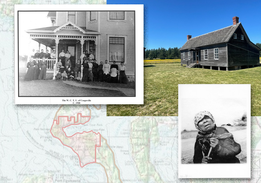
Harris Environmental supported Ebey’s Landing National Historic Reserve, a National Park Service Unit, and Wellesley College to develop a StoryMap using ArcGIS. The nearly 18,000 acre Ebey’s Reserve on Whidbey Island in the Puget Sound is home to over 400 nationally registered historic properties dating from the start of the Territorial Period (1850s) to pre-World War II (1940s). Preserved are farmhouses, dairy barns, chicken coops, boatsheds, farm equipment barns, and block houses. The area is the ancestral home of the Lower Skagit People and was occupied by other tribes, such as the Snohomish, Kikiallus, and Klallam. The land and water offered rich resources: tillable soil, shellfish, fresh water, and safe harbor.
The StoryMap illustrates the lives of indigenous and settler women, voices often ignored in history’s retelling. Viewers are encouraged to browse the interactive maps and read more about the agency of indigenous women during the Territorial period. The history of Ebey’s Reserve is complex, indigenous people thrived within the area prior to colonial settlement and maintained some influence within the economy well within the 20th century after the creation of reservations. During the Territorial period, settler women exercised much control over their estates and businesses and were influential for the economy and political culture on the Island.
View the Voices of Ebey’s Landing StoryMap
Historical Images: WCTU, 1908, Island County Historical Society, Janet Enzmann Archives (upper left) and Walalita “Squnity” Slapoose (lower right).
Copyright © 2025. Harris Environmental. All Rights Reserved.
Website by Leslie Evans & Salmagundi Design Studio
